
Upper Merion Previous Residents by Era
Previous residents of an Upper Merion Township address appear in layers, each tied to a different date and purpose. Start with the parcel card and the recorded transfer chain for the land. Then add a directory, map, census, archival record, or Township file that falls near the time in question. A source can show an owner, a household clue, a road name, or a construction event. It rarely proves all of them at once.
| Source | Years it covers | Where held | What it contributes |
|---|---|---|---|
| Recorder land-record holdings | 1784 forward, as stated | Recorder remote system, counter, and mail routes | Recorded transfers and the legal-description chain |
| PHMC deed-index microfilm | 1784–1877 | PHMC guide and archive routes | Early grantor and grantee navigation |
| HSMC deed books and index microfilm | 1784–1890 stated | Historical Society house-history route | Older deed-book research fallback |
| KoPHS Upper Merion directory | 1915 | Digitized historical-society PDF | Dated household snapshot and route or map codes |
| School district yearbooks | 1934–2013, with gaps | Upper Merion Library and POWER Library | Class-year identity clues, not address proof |
| Federal census | Released through 1950 | Library genealogy resources | Enumerated household facts at the census date |
| KoPHS maps and aerials | Documented items from 1849 through 2000 | KoPHS digital archive | Road, locality, and building-area continuity |
A permit-history start date was not published. For a later change at a known property, treat a Township permit or project file as date evidence and request the identified record. It is not a substitute for a deed or a dated household source. This table gives the previous-residents trail a realistic handoff from era to era rather than a fictional continuous database.
Upper Merion Parcel Card to Past Residents
The Montgomery County Property Records card is the present-day starting point for past residents research. Search by street address or parcel number, then capture PARID or TaxMapID, Property Location, current recorded owner, mailing line, last-sale date, sale price, book/page, grantor, grantee, and recording date. Owner-name search was removed from the portal in 2022, so a street address or parcel identifier must start the process.
Property Location is the situs address, the physical place on the parcel. The owner mailing line is a separate correspondence field. Do not turn either display into a statement about every person who lived there. The most useful handoff is the last-sale book/page. It turns a free address result into a specific place in the Recorder’s primarily name-indexed record trail.
That bridge is particularly useful when a surname repeats or a street address changed. Keep the legal description, subdivision or lot reference beside the PARID. The next deed should be tested against those land details, not only against a familiar road label.
Trace Upper Merion Previous Residents Through Deeds
The Recorder’s record trail identifies recorded land parties, while the previous residents question also needs dated household sources. Begin with the parcel’s last sale and use the Montgomery County Recorder Public Access System to locate the purchase document. The Recorder says county records date to 1784. Its public instructions confirm name, address, and parcel ID as search criteria after a remote user creates a free account.
- From the parcel card, record PARID, book/page, sale date, grantor, grantee, and legal-description clues.
- Locate the buyer as grantee in the deed that brought the property to that party.
- Read the legal description, subdivision or lot reference, date, and book/page alongside the street address.
- Use the seller as grantee to locate that party’s earlier acquisition, then repeat the comparison for each earlier transfer.
- When the online route does not reach the needed document, move to the Recorder counter, a mail-copy request, HSMC microfilm, or the county archival route.
- Grantor and grantee
- The grantor transfers an interest in the document. The grantee receives it. Their names place a recorded transaction, not a complete household.
- Chain of title
- The sequence of recorded transfers for the same land, followed backward by comparing each document to the prior acquisition.
- Legal description
- The land description in a deed or plan, often using lot, subdivision, or parcel references. It is more stable than a changing street label.
- Criss-cross directory
- An address-organized directory. No verified Upper Merion run was located, so ask the library to confirm a title and year before relying on one.
Upper Merion Deed Records Beyond the Screen
Remote access is only one Recorder channel. The Public Access System requires an account for remote searching, and document copies have their own payment route. The Recorder’s current page describes a $10.50 remote certified copy. The counter offers public computers, copies at 50 cents per page, and a $1.50 certified-copy surcharge. A mail request should include the owner name, property address with municipality, county parcel ID, book/page when known, and requester contact.
Mail requests also need a self-addressed stamped envelope and payment under the Recorder’s stated rules. The office gives general information by phone but does not perform the actual document search. These distinctions matter for an Upper Merion Township previous-residents search because an index result, an image, and a certified copy are different products. A record request should identify the document rather than ask the office to compile a personal history.
A captured Recorder copy-procedures page shows the online, counter, and mail paths for getting a document after its book/page has been identified.
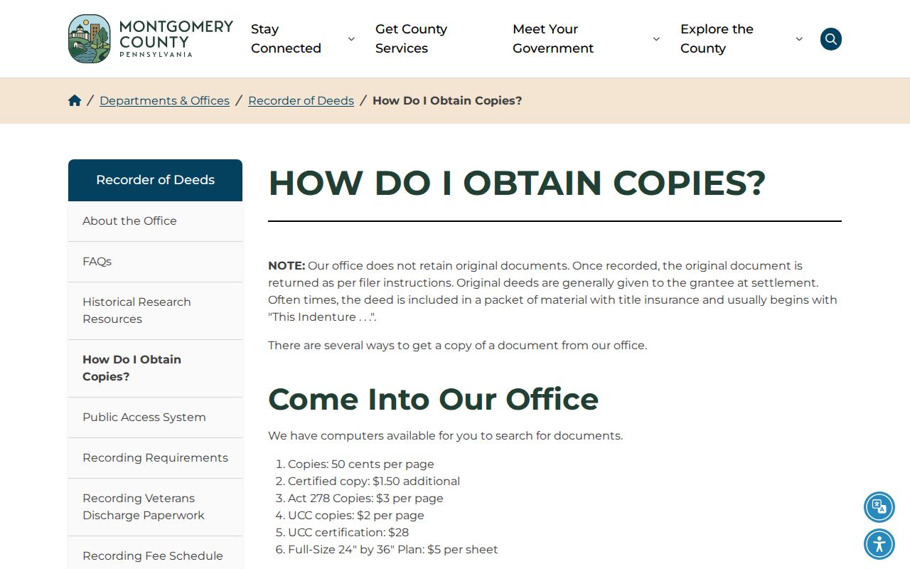
The copy options are a fallback for a known deed placement, not a replacement for checking the parcel and legal description first.
Note: The Recorder’s current indexing notice changes, so confirm its posted status before treating a recent missing item as a gap.
Upper Merion Records Before 1784
One historic boundary changes the custodian, not the land. Montgomery County was created from Philadelphia County on September 10, 1784. For Upper Merion land before that line, the proper next step is Philadelphia records. From 1784 forward, the Montgomery County Recorder and archival routes take over. A trail that stops at the county’s beginning may therefore be encountering a jurisdiction shift rather than a destroyed record.
The Historical Society of Montgomery County identifies deed books and index microfilm for the later historic period and directs earlier land research to Philadelphia custody. PHMC’s Montgomery guide also documents early deed books from 1784–1820 and grantor/grantee indexes from 1784–1877. Those are concrete backup layers when a web result is incomplete.
This division is a useful test for previous residents research: preserve the book/page, parcel, lot, and locality terms at the crossing point, then change the office searched. It is not safe to assume that an address label has stayed constant across that boundary.
Upper Merion Past Residents in 1915
The King of Prussia Historical Society offers a digitized 1915 Upper Merion directory, headed Montgomery County Directory. It is a dated household snapshot, not a modern list. Its key explains codes for acreage, children, telephone system, ownership indicator, rural route, and highway or map reference. The scan can add names and locality clues to a parcel trail when its date fits the question.
One visible entry names Thomas Cutler, Anna M. Cutler, one child, farming, an ownership code, acreage, Bell telephone, King of Prussia, and an H42 map reference. The value is in the combination of date, locality, and code. It should be tested against the deed’s legal description and a date-appropriate census or estate source, not treated as proof of a current family connection.
The King of Prussia Historical Society history resources provide a local route to place names, maps, and historical context around a prior address.
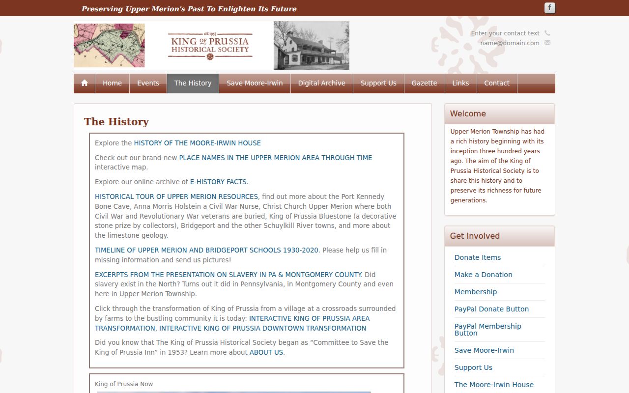
Use the historical-society material to date a locality or map clue, then return to parcel and Recorder records for the land chain.
Upper Merion Address Continuity Records
Maps and aerials help answer whether two address descriptions refer to the same place. KoPHS documents Upper Merion items from an 1849 map and 1893 atlas through 1912/13 atlas sheets, 1928 aerial imagery, Township maps from 1953, 1960, 1965, 1966, and 1988, plus 2000 aerials. This is the verified map sequence for an address-history search. No specific Upper Merion Sanborn map run was confirmed.
Name variants are another continuity check. Midway Lane changed to Reeseville Drive, though no reliable effective year was found. Older sources can write Gulph as Gulf, Abrams as Abrahams, or Swedes Ford as Swedesford. The 1915 directory also uses rural routes and historical postal localities. Search each original term, then compare it to an atlas, parcel ID, lot, or deed description.
The Upper Merion Township maps page supplies current official street, zoning, and flood-reference links. For an old building change or project file that maps cannot settle, use Code Enforcement or a focused Township Right-to-Know request with an address and time period.
Upper Merion Past Households in Dated Records
Past residents are easier to evaluate when directory, census, and land dates are paired rather than blended. The Upper Merion Township Library provides Ancestry Library Edition for in-library use and HeritageQuest for remote genealogy research with a library card. Census releases currently run through 1950. Search the closest released census to the directory or deed date, then compare the household’s locality and name spelling to the property trail.
- Place the parcel in a time window using the last-sale date or a recorded deed.
- Check the 1915 directory or a dated map for the historic locality, route, or road clue.
- Use the closest released census available through the library to test the household at that time.
- Use an obituary index, public-aged vital record, probate record, or archival file to close a later gap, while keeping the date of each source visible.
The Historical Society of Montgomery County is a practical archival fallback for maps, tax-record microfilm, family histories, newspapers, and its Upper Merion collection. Its Norristown Times Herald obituary-index spans are limited, so give staff the deceased’s name, newspaper, and publication date when requesting a copy. The historical collections themselves are explored in more detail on the Upper Merion Township city directories page.
Note: A dated household record supports the date it was made, not an unbroken claim about an address before or after that date.
Upper Merion Previous Residents Limits
A deed chain follows recorded land transfers, not every person who occupied a property. A directory or census can add a dated household clue, but it must be tied to the right locality and time. Property owner and mailing fields are also not a complete list of occupants. Protected addresses may display a substitute under Pennsylvania’s Address Confidentiality Program, and motor-vehicle and utility records are not a public path around those limits.
When a record appears wrong, contact the office that maintains it. Assessment and Recorder records have different custodians from voter, court, vital, and Township files. Preserve the date, source URL, document placement, and a copy citation so a mismatch can be checked without guessing. Previous residents research is strongest for family history, estate questions, and the documented history of a place.
Lawful use. Use Upper Merion address history for personal, lawful research. Do not use a past-resident result to threaten, stalk, harass, or harm anyone.