
Upper Merion ZIP Code Coverage
Four postal ZIP codes have verified Upper Merion address evidence. They are working routes, not a claim that each ZIP lies wholly inside the Township or that the list is a complete USPS boundary file. Official Township, county-planning, and election-address sources place particular Upper Merion locations under King of Prussia, Bridgeport, Wayne, and Conshohocken mailing labels. The distinction is important when a familiar postal city appears to point outside Upper Merion even though the parcel is in the Township.
| ZIP code | Upper Merion area or official-address evidence | Postal city on official address | Records-search note |
|---|---|---|---|
| 19406 | Township Building and polling locations in Candlebrook, Belmont, Gulph, King, and Swedeland | King of Prussia | Main Township postal designation, not a municipal boundary. |
| 19405 | Swedesburg polling location on Jefferson Street | Bridgeport | An Upper Merion area can use a Bridgeport postal city. |
| 19087 | Roberts/Town Center polling location on Croton Road | Wayne | A Township pocket uses this Wayne postal label. |
| 19428 | Upper Merion KOP Logistics Hub on River Road | Conshohocken | River Road illustrates another postal-city mismatch. |
Use the table to recognize an address format, then verify the exact delivery address before drawing a geographic conclusion. The research did not establish a Township-wide USPS list, a ZIP realignment date, a PO-box-only code, or a unique institutional code. The four routes are therefore verified examples with local records value, not a substitute for a live postal lookup.
Upper Merion ZIP Code Postal Cities
King of Prussia is a postal and community name within Upper Merion Township, not a separate Township records office. The same rule explains why Bridgeport, Wayne, or Conshohocken can appear in the mailing line for an Upper Merion address. Township government keeps its own permits, planning, maps, and Right-to-Know records, while Montgomery County maintains the parcel roll, Recorder land records, and many court and election functions. A postal city tells the Postal Service how to format delivery. It does not choose the property-record custodian or redraw the Township line.
Use two checks. Confirm the delivery label through USPS, then confirm jurisdiction with the physical street address, Municipality field, parcel identifier, and map layer.
The Upper Merion official maps page supplies the street, zoning, and flood-reference map routes that put a postal result in local context.
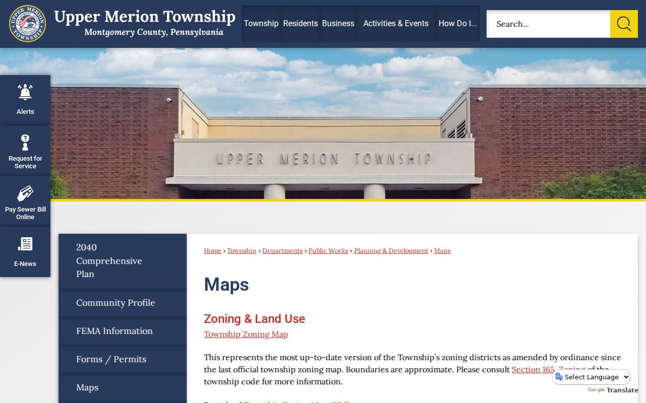
Match the street to the map before treating a mailing city as a jurisdiction clue, especially near a park, river corridor, or municipal edge.
Note: A ZIP code is useful for delivery formatting, while the municipality and parcel identify the government record route.
Validate an Upper Merion ZIP Code First
A ZIP code directory can help organize an address question, but the county property system does not offer a ZIP-wide owner or address filter. Begin with the exact street-number delivery address in the USPS ZIP Code Lookup. Then carry the returned formatting into the county address search. This sequence prevents a postal-city label from replacing the municipal and parcel details the record systems actually use.
- Check the complete delivery address with USPS and record the preferred mailing city and ZIP code with the date checked.
- Use the Montgomery County Property Records address search with the number and street, then choose
UPPER MERIONif the result set crosses municipal lines. - Add direction, suffix, or unit when duplicate street names or multiple address formats remain.
- Save the parcel identifier, also called PARID or TaxMapID, and use it in the county GIS viewer or Recorder research.
- For a full address-by-address chain, continue with the Upper Merion street directory rather than treating the ZIP as the final search key.
A ZIP filter does have a narrow official use in the Pennsylvania Liquor Control Board license search, which accepts ZIP and ZIP-range fields along with county, municipality, licensee, officer, street, and premises information.
| ZIP / ZIP range | Postal-location criterion for a regulated-premise search, including from and to fields for a range. |
|---|---|
| County and municipality | Geographic fields that can narrow a license result beyond the postal route. |
| Licensee and officer name | Named party fields within the state license index, not a county property search. |
| Street and premises | Address-related fields for the regulated business location. |
The PLCB License Search is the source for the ZIP-capable regulated-premise form shown here.
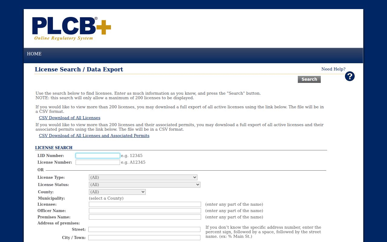
That screen can help locate a regulated premise by ZIP, but it is a license index and does not supply a Township resident or household directory.
Upper Merion Property Records Without ZIP Filters
The public property portal is designed around the parcel, not the postal route. Its address form requires Street and can accept a Number, Direction, Suffix, Unit number, and Municipality. Search results may be sorted by parcel ID, owner name, property address, sales date, sales amount, land-use code, or TaxMapID. Owner-name searching was removed in June 2022, so a name is not the correct starting point. Reach the address or parcel card first, then read the recorded-owner and mailing fields in their proper context.
| Street | Required field. A full term returns that street; a partial term can return containing addresses. |
|---|---|
| Municipality | Optional countywide field. Choose UPPER MERION to narrow an address result. |
| Direction, suffix, unit | Optional refinements that distinguish a road direction, street type, or individual unit. |
| PARID / TaxMapID | Parcel identifiers that carry the property result into mapping and Recorder research. |
Advanced property criteria include municipality, street number and name, parcel number, sales date or price, lot size, land-use code, building details, and TaxMapID. ZIP is absent from both address and advanced search. That limit makes the ZIP code directory a navigation layer, not a promise of a ZIP-wide parcel list.
Three Upper Merion Address Geographies
Once the portal opens a property card, keep the address labels separate. The physical location, correspondence line, and recorded land description can each use a different geography. A mailing address may be elsewhere or may serve only for correspondence. A deed can identify a lot, subdivision, or legal parcel without repeating the preferred postal wording. These labels are clues for the next record, not interchangeable statements about where a person lives.
- Situs or Property Location
- The physical street address attached to the parcel card.
- Owner mailing address
- The correspondence address shown for the recorded owner. It can differ from the physical property location.
- Legal description
- The deed or plan description that may identify a lot, subdivision, or parcel instead of a delivery label.
- ZIP+4
- An added delivery detail for an address. It does not establish Township jurisdiction or a parcel boundary.
The Montgomery County Recorder Public Access System is the next place to match the parcel’s book, page, and legal description to recorded documents. Remote search requires an account; the Recorder counter and copy-request routes remain alternatives.
Note: Mailing and situs fields can be different without either one proving a complete household at the property.
Map Upper Merion ZIP Code to Parcel
After the county address search returns a PARID, use the Montgomery County GIS parcel viewer to see the parcel in relation to roads and surrounding mapped features. The Township map page adds road classifications and local street context. Private-road maintenance or a zoning line may matter to a map question, yet neither changes the recorded property owner or turns a postal boundary into a Township boundary. County tax maps are visual aids, not certified boundary surveys.
For a map, GIS file, or planning question not exposed online, Township staff can provide the applicable public route. For an older address-specific permit, planning, or administrative file, the Upper Merion Right-to-Know request route asks for the record type, time frame, and a specific description. Give the street address and PARID when known. A request seeks existing records, not a new ZIP-based directory.
Historic Upper Merion ZIP Code Pitfalls
Postal boundaries cannot solve every older address problem. Midway Lane changed to Reeseville Drive, although research did not identify an effective date. Historic sources can also use Gulph instead of Gulf, Abrams instead of Abrahams, and Swedes Ford instead of Swedesford. The 1915 Upper Merion directory relies on postal communities and rural routes rather than a modern, complete street-number index. A modern exact-address search can therefore miss the same land under an older road or locality form.
For a dated address question, preserve the old spelling, compare the official street map with historic maps or atlases, and use the parcel’s legal description to bridge the terms. The King of Prussia Historical Society collections and county Recorder records are better historical companions than a modern ZIP alone. A past household or address trail belongs with the previous-residents search, where the dated deed and directory layers can be compared directly.
Upper Merion ZIP Code Directory Limits
Use a ZIP code to verify delivery, distinguish postal labels, and begin an address search. Do not use it to estimate Township population, precinct totals, property counts, or the people connected with every address in that route. ZIP areas can extend beyond the Township line, and a Township address may use a neighboring postal city. A parcel card also records property facts, not a list of every person associated with a location.
Respect protected information. Pennsylvania address-confidentiality protections and other privacy rules can limit what a public record displays. Use public records for lawful personal research, and never use an address result to harass, stalk, or harm anyone.
When the question is about nearby parcels rather than delivery formatting, use the mapped workflow in the Upper Merion neighbors lookup. When it is about one person, compare independent public records rather than treating a postal label as identity proof.
Note: Recheck USPS formatting and live county portal controls because delivery labels and searchable record systems change independently.